Monumental Road: 1858-1862
The Story of Captain John Mullan’s Historic Road Across the Pacific Northwest
…and the Path Towards Making the Road a National Historic Trail.
By: Tara J. Foote
Illustration of the Mullan Road on 4th of July Pass
“From the end of the lake Coeur d’Alene to Spokane Bridge, twelve miles, the road is perfect. At the bridge we came to the first mail-station on this side of the continent, and from there had the choice of three good roads to Walla Walla. Captain Winters chose the most direct one (the Mullan Road) across Snake River, and we traveled by it 160 miles in five days, reaching Walla Walla in perfect order and condition in fifteen days from Missoula.”
Table of Contents:
Part One: Lt. John Mullan and His Military Road
Part Two: The National System of Trails Act of 1968.
Part Three: National Scenic and Historic Trails. Knowing the Difference.
Part Four: Historic Designation
Part One: Lt. Mullan and His Military Road
Like a great idea, trails and roads lead us down a path of undiscovered territory. An intimate space that encompasses both the mind and the land. Every step forward is a perspective never seen before and each time we travel, we are accessing both our experience of the place as well as the place itself. This is what makes us human and what inspires us to build roads, write poetry, and go on pilgrimage in the first place. As the saying goes, one can never travel the same road twice and it’s true, one cannot. This is because our perspective is a fluid thing. It is, by its own nature, always in flux. And so, because we are human, we memorialize our journey. This is the story of one man’s journey towards greatness and the trail that brought him there.
As acting Governor of the Washington Territory in 1853, Isaac Stevens sent a party of men from “St. Paul, Minnesota to Puget Sound” to “explore a northern route for a transcontinental railroad.” The explorers were assigned to the Northern Rockies section of the Pacific Northwest. Included in the group was a promising topographical engineer for the U.S. Army named Lt. John Mullan. During his first winter in the bitterly cold mountains of the Northwest, Mullan hunkered down and collected data about the area, surveying a route from Fort Walla Walla, Washington to Fort Benton, Montana, a journey that would extend over 600 miles and across three Western States. A recent ambitious graduate of West Point Academy, Mullan had his sights set on greatness. With a military mind and a poet’s heart, his road was to become the most modern road of its kind in the newly settled West, the very first “engineered highway.”
For a few years, it was the primary route for traders and prosperous miners into the promising gold territories of Montana and Idaho. Mullan and his men believed that “in any event the Army must do what it can to prepare the way for the emigrant, and to keep the peace as far as possible during this epoch.”
Once Governor Stevens of Washington State gave the green light to “appropriate(d) funds for the construction of the wagon road in 1858,” Mullan set out on a mission to build the most ambitious road ever attempted in to the Pacific Northwest. Despite a setback of “indian troubles” during the 1858 Battle of Four Lakes and the defeat at Steptoe Butte, the road officially broke ground in 1859 and was impressively finished in 1861, a mere two years later. The men could not have known that their fine feat of engineering would be all but washed away by floods, after only a few brief years of service. It seems that ever since, the Mullan Road has been shrouded in some mystery. Records of where the road went remain preserved in archives and old maps but finding the actual road, in many cases, is a best guess scenario.
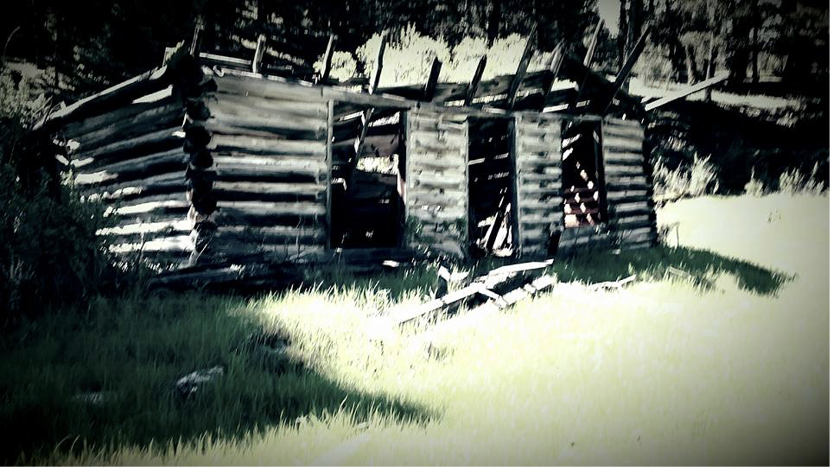
Pioneer Ghost Town, Western Montana. A once thriving community along the Mullan Road
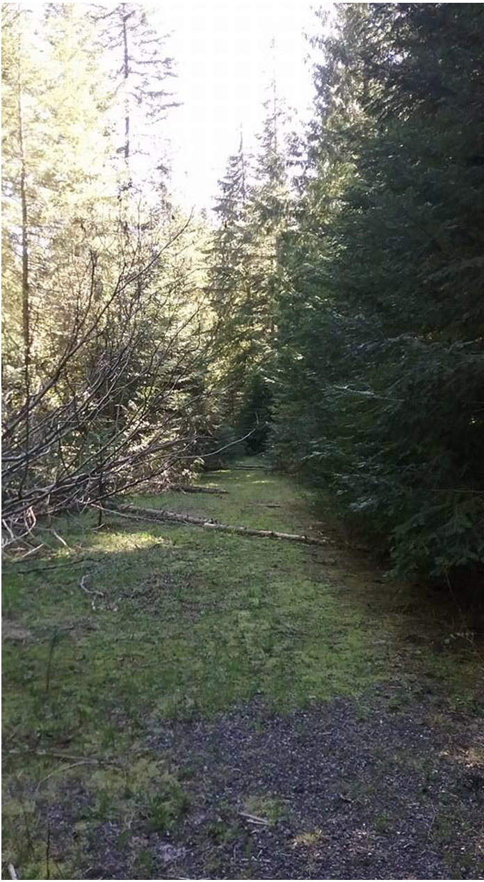
A likely stretch of Mullan’s original road on 4th of July Pass, Idaho.
We know the team of men worked “easterly” from Walla Walla towards Idaho and Montana constructing “twenty heavy bridges” along the Coeur d’Alene River alone, before “crossing the summit of the Bitterroot Mountains” until they reached the “head sources of the St Regis Borgia River” upon which a “similar system (of bridges) were initiated.” But John Mullan seemed conflicted at times. Several points along the way troubled Mullan. Even though he had “fully explored the region, even as he was building the road…he changed his mind about the road’s location. From 1860-1862, he spent considerable effort in rerouting several sections of the road.” Later on, his wanderings coupled with significant wash out of the original route would cause speculation for historians that carry on to the present day.
Engineer and Captain John Mullan’s assistant, W.W. Johnson, initially “studied the route from the standpoint of constructing a railroad.” In the end, a road was built instead and Johnson’s knowledge of the road and attention to detail proved immensely helpful to the overall quality of the road and the timeliness for which the road was completed. Considering that Mullan and his team lacked high tech surveying equipment, the crew nonetheless worked with incredible accuracy and knowledge of the wilderness area they were assigned to. Their contribution to this monumental road at a time when modern conveniences and amenities were not available are a testament to the skill and ingenuity of the men. In his own report to Mullan, Johnson wrote:
“the summit of the divide of the Coeur d’Alene or Bitter Root Mountains at Sohon’s Pass is four thousand nine hundred and thirty two feet above the level of the sea,…and thirteen hundred and fifty three feet above the last crossing of the Coeur d’Alene river, which last height is attained in an air line distance of one and five hundredths miles…the descent of three hundred and ninety two feet from the summit, to the first crossing of the St. Regis Borgia is made in seven tenths of a mile, in nearly a direct line, over the natural surface of the mountain…there are two passes to the north and east of Sohon’s Pass; the first two miles to the north…the second is some ten miles distant…The St. Regis Borgia river has its rise in a small Bowl-like lake 500 feet in diameter, carved by nature out of the steep rocky walls of one of the spurs of Steven’s Peak. After leaving this spring it tumbles down 300 feet in a quarter of a mile, through a narrow, rocky channel; after which it flows through a valley a tenth of a mile in average width, to the first crossing.”
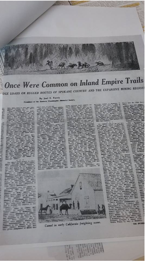
With the road complete, the route was open to travelers, many of whom were making the long journey from the West into Montana. Traveling long distances by wagon or horseback meant being able to pack all that was needed for the journey. Horses were of course the primary method of travel but for some, extra help was needed to make the journey over the high mountain passes. It was reported that even camels carried “merchandise to the camps in the gold gulches and the miners in Bear Gulch, Gold Creek and Deer Lodge became accustomed to the arrival and departure of the camel train. At length the camel train was placed on the old Walla Walla trail out of Hell Gate or Missoula.”
Mr. James Watt, a settler of Cheney, Washington in 1883 recalled in an article for the Spokesman Review that on April 15th, 1928, that “many early day experiences in the mining districts of Idaho…”drove pack trains from Walla Walla into the Idaho mines at Pierce City, Oro Fino, in 1862, and over the Mullan Road to Helena in 1865, into Colville in 1866.” Local Indians also recall the camel trains in the “Colville and Spokane Valleys.” “Those seen in the Spokane country were packing from Walla Walla eastward into Montana.” It seemed that everyone was itching to get their hands on the rumored gold in the Montana Territory.
Whether travelling by horse or camel however, Mullan, in his initial report, recommended treating the animals with the utmost care and respect, lest you end up with a wily critter on your hands. Mullan told travelers of the Mullan Road to make sure the animals were “regularly watered, morning, noon, and night. Never maltreat them, but govern them as you would a woman, with kindness, affection, and caresses, and you will be repaid by their docility and easy management.”
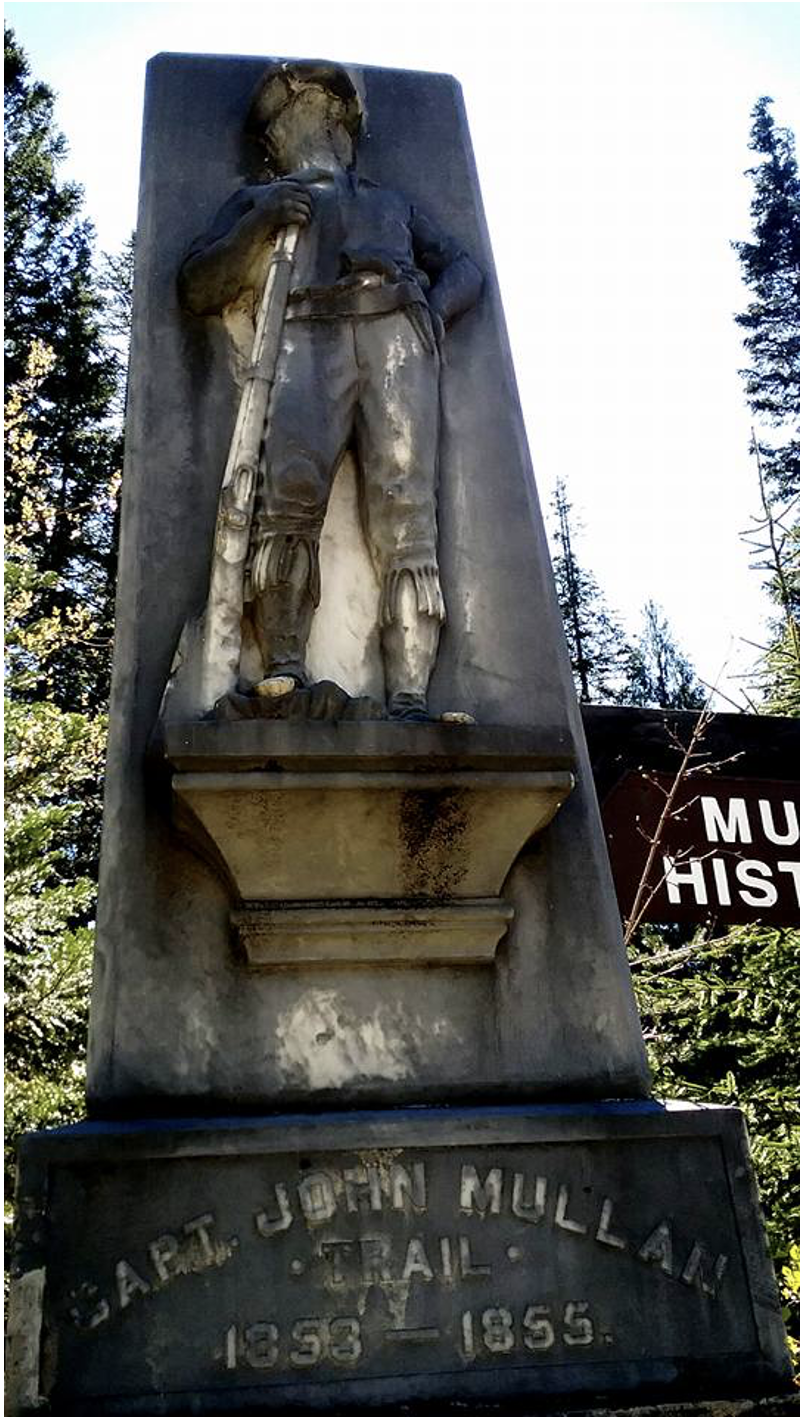
During part of the construction period the road was still being referred to as the ‘Military Road.’ An article that appeared in the Spokesman-Review in 1917, noted that now there were eight notable markers funded by individual cities along its route and erected in honor of Captain John Mullan. At an estimated $1000 being spent per monument, it was no small expense.
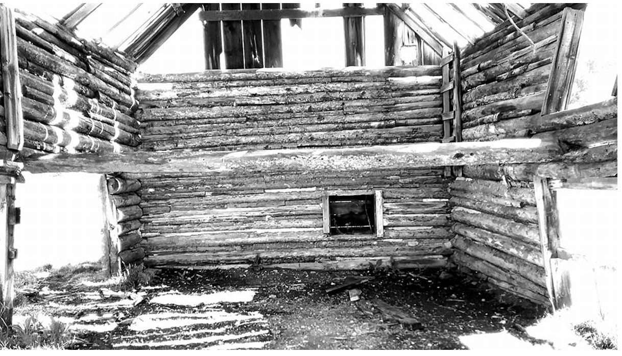
By the 1920’s, modern ways seemed to crush the pioneer way of life and ghost towns began to appear along the aging route. The “passing of the pioneer’ and the “picturesqueness of our Nation and somewhat of the heroic in our national life” had officially disappeared.
Despite the knowledge that the Mullan Road contributed to the development of the West, the road has yet to gain national attention as an important historic landmark. This thesis is an ongoing project intended to find out just how someone might go about the process of national designation of an historic route such as the Mullan Road. In some ways John Mullan looked for some fame to be found in his road throughout his life. A national designation would post humus award him this honor. In a letter to then President Lincoln in 1863, after the 37th Congress, Mullan advertised his efforts in the area:
For the last ten years I have resided within the region now organized into a Territory, and…by my labors and Explorations have added to the development and progress of that region by opening a communication from the head Waters of the Missouri to the Head Waters of the Columbia River by which Immigrants from the North West have found a new route to the Pacific. -Captain John Mullan
Part 2. The National System of Trails Act of 1968.
The National Park Service was created August 25, 1916 under the supervision of the Department of the Interior. Its presence among government programs opened the door for the preservation of not only National Parks but also National Trails, byways, roads, and historic monuments, battlefields, and sites. On October 2, 1968, the National System of Trails was added under the umbrella of the National Parks Service and Department of the Interior. The process of gaining historic trail status is a long and tedious bureaucratic process that can take months of preparation and sometimes years. Decades after this new department was established, there are still only around 30 trails that have been approved by Congress as National Historic Trails or National Scenic Trails, though there are dozens more recreational trails. It is important to understanding this project to bear in mind that the Mullan Road primarily fits into the category of historic trail, and not scenic, although there are parts of the Mullan Road that you can indeed walk upon. The purpose of historic trails is not intended for recreational purposes, but rather as conceptual reminders of our National story.
Scenic Trails include routes like the Pacific Crest National Scenic Trail, which runs from the border of Mexico and California to the international border of Washington State and Oregon and the Appalachian Trail. The Pacific Crest National Scenic Trail and the Appalachian National Scenic Trail were the purpose of the National Trails Systems Act of 1968 as local groups asked for protection through similar “Friends of the Trails” organizaitons . Like National Parks, scenic trails encourage recreational use in a safe and educational way. It is the purpose of scenic trails to be used in recreational ways.
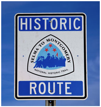
By contrast, historic trails are not intended to be hiked in their entirety and in fact, in many instances, cannot be since most historic trails run right through private property. The Selma to Montgomery National Historic Trail is one example of an historic route that gained its status through an historical event. National Historic Trails tell a story of human movement, ingenuity, and progress. To return to these places is to walk in the footsteps of our shared past.
Part 3. National Historic Trails and National Scenic Trails
The following is a list of most of the 30 National Historic and Scenic Trails preserved through the National System of Trails Act following its establishment in 1968. They are each unique and each important to our national story.
Name of Trail Year established Length of trail
Oregon National Historic Trail
1978 2,170 miles
Mormon Pioneer National Historic Trail 1978 1,300 miles
Lewis and Clark National Historic Trail 1978 3,700 miles
Iditarod National Historic Trail 1978 2,350 miles
Overmountain Victory National Historic Trail 1980 275 miles
Nez Perce (Ne-Mee-Poo) National Historic Trail 1986 1,170 miles
Santa Fe National Historic Trail 1987 1,203 miles
Trail of Tears National Historic Trail 1987 2,200 miles
Juan Bautista de Anza National Historic Trail 1990 1,200 miles
Trail of Tears National Historic Trail 1987 2,200 miles
Juan Bautista de Anza National Historic Trail 1990 1,200 miles
California Trail 1992 5,665 miles
Pony Express National Historic Trail 1992 1,966 miles
Selma to Montgomery National Historic Trail 1996 54 miles
El Camino Real de Tierra Adentro National Historic Trail 2000 404 miles
Ala Kahakai National Historic Trail 2000 175 miles
Old Spanish National Historic Trail 2002 2,700 miles
El CaminoReal de los Tejas National Historic Trail 2004 2,700 miles
Captain John Smith Chesapeake National Historic Trail 2006 3,000 miles
Star-Spangled Banner National Historic Trail 2004 290 miles
Washington-Rochambeau Revolutionary Route National Historic Trail 2009 600 miles
North Country National Scenic Trail 1980 4,600 miles
Continental Divide National Scenic Trail 1978 3,100 miles
Pacific Crest National Scenic Trail 1968 2,650 miles
Appalachian National Scenic Trail 1968 2,181 miles
Florida National Scenic Trail 1983 1,300 miles
Ice Age National Scenic Trail 1980 1,200 miles
Pacific Northwest National Scenic Trail 2009 1,200 miles
Arizona National Scenic Trail 2009 807 miles
Potomac Heritage National Scenic Trail 1983 700 miles
Natchez Trace National Scenic Trail 1983 695 miles
New England National Scenic Trail 2009 220 miles
The National Trails System Act of 1968 that created these historic and scenic trails was in many ways an extension of both the Organic Act of 1916 and the Olmsted Report of 1865. In the beginning, we preserved land as public parks. This idea of land preservation was an American invention and may prove in the future, our greatest legacy. Following the establishment of Yellowstone National Park, a trend to preserve great expanses of land and wilderness contributed to many more National parks and wildlife sanctuaries. As time went on and the idea gained popularity, proving both useful and patriotic, further consideration was given to less obvious examples of national pride in our public history, such as the preservation of historic sites and trails. The purpose was then as it is now; to preserve land while allowing the maximum amount of enjoyment for the people. This was true of the Organic Act, the Olmsted Report, and in 1968, the National Trails System Act.
The following is a map of National Historic and Scenic Trails since 1968.
https://www.nps.gov/nts/maps/National%20Trails%20map.pdf
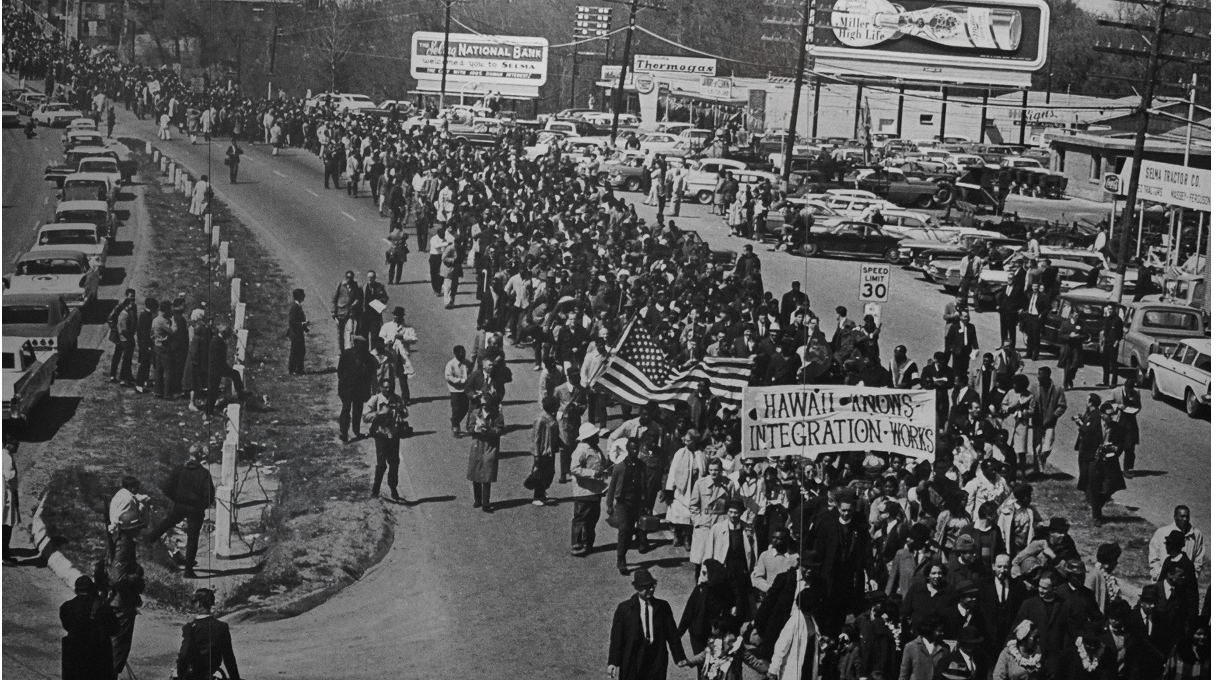
Most of us imagine a trail to be something like a meandering dirt path through a well preserved, protected, semi-maintained expanse of land, in a National Park, Wildlife Refuge, or along the banks of a beautiful lake or river. When African Americans marched from Selma to Montgomery on March 7, 1965, they hiked on hard concrete, past factories, and shopping centers. Their “trail” was born of a concept. A belief. A demonstration. Their path, although urban and not for recreational purposes or migration, was significant enough to become a National Historic Trail. When we expand the use of the word ‘trail’ in our vocabulary we find that ‘trail’ can have many meanings and come in many forms. What symbolizes a trail more than anything else is the forward movement of people with a destination in mind, dirt or driveway.
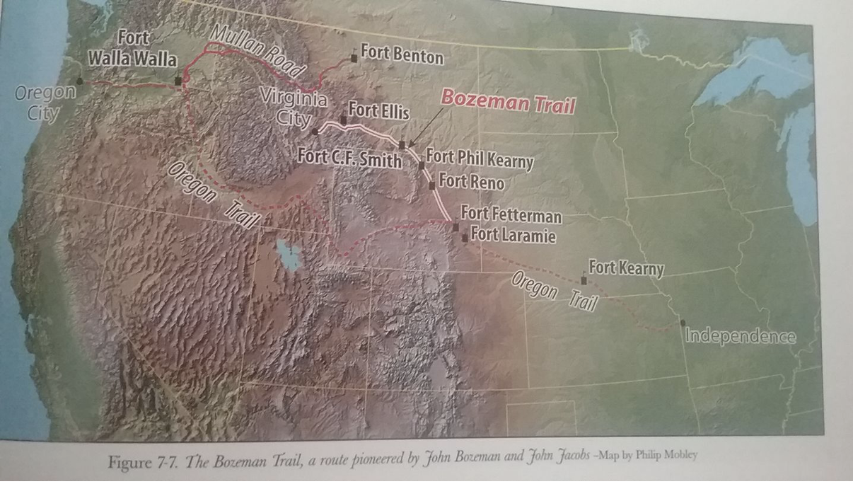
Historians have traditionally referred to the Mullan Road as a ‘road’ and they were right. The Mullan Road was a road, but was it not also a ‘trail?’ A route? A path? Under the National System of Trails Act, any path or route travelled by Americans in any way that contributed to history qualifies as a ‘national trail.’ This means that our Mullan Road, which runs from Ft. Benton, MT to Walla Walla, Washington is eligible for National Trail System designation as well.
One reason for the designation of The Mullan Road is the road’s use as a transportation corridor that influenced settlement patterns in the Inland Northwest, including the Palouse region of Eastern Washington, an area that has since become an internationally recognized wheat producing agricultural region. In 1879, The Spokane Times reported that the Mullan road was an important emigrant route in the Inland Northwest noting that many “immigrants would come over the road” in the first year, contributing to the swelling populations of a collection of very small settlements scattered among the Pacific Northwest, including the Palouse, Spokane, Lewiston, and Walla Walla.
What makes the road unique is its contribution to western history, and to the national story. Since we have determined the Mullan Road to be an important historic route, it is important to take a closer look at some of the other National Historic Trails and how they achieved their status.
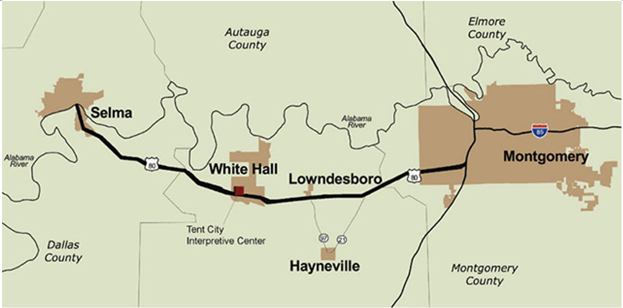
The Selma to Montgomery National Historic Trail commemorates the long journey of African Americans and their right to vote. President Lyndon Johnson signed the Voting Rights Act of 1965, which promised equality and voting rights for African Americans. Dr. Martin Luther King Jr. led the march from Selma to Montgomery, a 54 mile trail to freedom. Following two unsuccessful attempts by protestors, including an infamous day in our nation’s history now known as bloody Sunday, the Selma to Montgomery march in Alabama officially began on March 21st, 1965. It is estimated that 25,000 people participated, which led to Johnson’s signing of the Voting Rights Act just five months later.
This historic route was recognized by Congress as a National Historic Trail in 1996 to commemorate the route and the people who risked their lives during America’s civil rights movement. Today, the route is also a National Scenic Byway/All American Road. Visitors “are encouraged to drive the historic route from Selma to Montgomery, Alabama” to “view the significant sites along the 54 miles trail, and take part in the trails’ year-round special events.”
The Selma to Montgomery Civil Rights protest of 1965.
The 54 miles stretch of road that makes up the Selma to Montgomery National Historic Trail
Part 4. Historic Designation
Gaining Historic Trail status can be a long and tedious bureaucratic process that can take months of preparation before a bill becomes law. Decades after the National Trails System Act became a new department under the National Parks Service and the U.S. Department of the Interior, there are still only around 30 trails that have been approved by Congress as National Historic Trails or National Scenic Trails. The Mullan (military) Road would indeed be an historic route and not a scenic or recreation trail. To clarify the application process (or lack thereof) the designation of National Historic Trails is not actually an application such as would be needed for a scenic trail, but rather a report turned over to each state’s Congressional Representative.
According to Helen Scully, National Recreation Trails Coordinator in Washington, D.C., There are three major steps to historic trail status.
1. Representatives request a study be done on the proposed trail, in this case, the Mullan Road. Study will be based on the research originally presented to our state Representatives by the individual, group, or both, lobbying for historic trail status.
2. Congress agrees or denies a study on the proposed area.
3. If agreed upon a comprehensive management plan will be created by Congress and finally a decision will be made and bill will become law.
This process, from citizen interest to state representation, to federal comprehensive plan, according to Helen, could take “up to 10 years” in some examples before there is a formal designation of the area so it is crucial to the time line that the initial research presented to the state representatives is both thorough and convincing. Congress needs to be convinced primarily that the area in question is important to the local region as well as to our national story. This is where the many road markers, historic monuments and sites, as well as supporters of the road, both professional and amateur really come into play in the process towards historic trail status.
If you go to the National Trail Systems website, www.nps.gov/nts and follow the link towards the National Trail System’s Part B, Section 5, you will find the three primary requirements Congress will be looking for from the Senators or representatives in their proposal. These three provisions summarize a trails historic relevance to the area and if possible, to the rest of the nation. Because the Mullan Road was a major immigration route during a crucial period of western expansion, and because the road was such a feat of engineering, ahead of its time in many ways, it is unlikely we should find reasons not to support its significance historically to our nation and to the Pacific Northwest. In addition, the road follows or is adjacent to the Lewis and Clark trail, the Nez Perce NHT, several wildlife refuge areas as well as important western historic sites and national forest land. The Mullan Road project should find significant evidence for Congress to agree upon a proposed study of the area and an eventual comprehensive management plan
In preparation for a successful report to our state representatives in all three states, Helen Scully suggested that it would be a good idea to get support and approval from other organizations familiar with the project and whom have had success with their own historic trail designations. The National Trail Systems Act was initially set up with the intent of collaborating with other organizations, primarily non-profits, who could work together in partnership for success. Perhaps the best organization to contact prior to contacting representatives is the National Trail System Coalition. There are also many other ways to show there is support for the road such as a signed petition of support for the historic designation of the road as well a thoroughly documented list of all of the Mullan Road’s historic monuments.
The National Trail System Coalition’s purpose is to support individuals during the preparation of their initial reports. According to Helen Scully, the coalition will coach us on “what to say” in our reports, which is the first step in trail status. If the report does not pass through state representatives, the bill will never make it to Congress so it is important to use the right language from the very beginning. The Executive Director of the NTS Coalition is Gary Werner, located in Madison, Wisconsin. The partnership holds a meeting in Washington D.C. every February. They are considering holding their 2018 meeting this coming year in the Pacific Northwest, which may prove promising for our report on the Mullan Road. This year will be the 50th anniversary of the National Trail Systems Act.
Historic designation is applied to trails and roads that adhere to the following three requirements of the original act by Congress in 1968.
Section 5(b)(11) of the National Trails System Act, a trail must:
(A) be a trail or route established by historic use and must be historically significant as a result of that use. The route need not currently exist as a discernible trail to qualify, but its location must be sufficiently known to permit evaluation of public recreation and historical interest potential. A designated trail should generally accurately follow the historic route, but may deviate somewhat on occasion of necessity to avoid difficult routing through subsequent development, or to provide some route variations offering a more pleasurable recreational experience. Such deviations shall be so noted on site. Trail segments no longer possible to travel by trail due to subsequent development as motorized transportation routes may be designated and marked onsite as segments which link to the historic trail.
(B) It must be of national significance with respect to any of several broad facets of American history, such as trade and commerce, exploration, migration and settlement, or military campaigns. To qualify as nationally significant, historic use of the trail must have had a far-reaching effect on broad patterns of American culture. Trails significant in the history of native Americans may be included.
(C) It must have significant potential for public recreational use or historical interest based on historic interpretation and appreciation. The potential for such use is generally greater along roadless segments developed as historic trails and at historic sites associated with the trail. The presence of recreation potential not related to historic appreciation is not sufficient justification for designation under this category.
The Mullan Road has potential for recreational use as well as many areas of historical interest based on historic interpretation and appreciation. Not only do portions of the old road cross over traditional trails used by Native Americans for centuries before the arrival of Westerners, it also crosses through stretches of trail used by the famous explorers Lewis and Clark. In addition, sections of the Mullan Road pass through geological formations and landscapes that were carved out during the Missoula flood, now recognized by geologists and historians alike as the largest flood in the history of the world. There are ghost towns and other historic wonders and recreational spots that would create a balance between the access of the road for teaching and recreational purposed while preserving the historic nature of the road as a somewhat conceptual route. One of the major concerns about historic designation are the private landowners who hold claim to property where the Mullan Road once ran. In answer to their concerns, an historic trail is much different than a scenic trail. Historic trails are not designed to be trespassed in their entirety. Instead, the road is meant to be preserved as an historic contribution to history, while portions of it, remain open to the public for historic interpretation. For the most part, this is how the road exists today, with recreational spots for historic interpretation and then other parts of the road that remain off limits, such as the portions where private land owners live.
As required by the National Trail System, the trail must provide opportunities for recreation that also hold historic relevance and appreciation. It is “not sufficient justification” to designate a trail for recreational purposes alone. Several areas have already been recognized as important historical areas that also include recreational opportunities. The Point of Rocks Historic Corridor in Montana, for example, which was established in 2009 by the National Park Service as an historic site, lies along the Mullan Road. This area has historic significance as an ancient site as well as an important site in the history of western migration, settlement, expansion, economic development, and transportation. In addition, the road has earned several prestigious awards including an engineering award given in 1977 from the American Society of Civil Engineers who designated John Mullan’s road an historic civil engineering landmark.
The following is an excerpt from the original document provided by the United States Department of the Interior, National Park Service and the National Register of Historic Places Registration Form required to designate the Point of Rocks area an important historic site along the Mullan Road. Point of Rocks Transportation Corridor is located two miles west of the town of Alberton, Montana along in the Bitterroot Mountains, which were passed by Lewis and Clark and their expedition in 1805.
Following an aboriginal trail, the Point of Rocks Historic Transportation Corridor consists of two linear features, a segment of the Mullan Military Road (24MN133) and an abandoned segment of the Milwaukee Road Railroad (24MN164), that wind their way along and above the north side of the Clark Fork River about two miles west of Alberton. Because these segments required the use of explosives to construct through the Precambrian rocks of the canyon, they still retain many of the features associated with road-building activity.
All along the Mullan Road, monuments such as that at Point of Rocks can be found. Those who have cared have preserved. Today, there is a group acting as the unofficial “Friends of the Mullan Road” who hold a conference at a location along the Mullan Road each year. This year, I attended their annual conference in Deer Lodge, Montana for three days in May, and had a chance to present the possibility of Historic Trail Designation to a group of professional and amateur historians of the Mullan Road. If there were a “friends of the trail” for the Mullan Road, these folks would almost certainly be it. All weekend, presenters offered their own piece of the puzzle in the mystery of the Mullan Road. There were presentations on the early gold rush in Montana and the benefits of transforming historic data with modern mapping and GIS software.
Pioneer Ghost Town, Montana.
During the Mullan Road Conference, attendees gathered for a field trip to nearby ghost town, Pioneer, and the purported location where gold was first found in the state of Montana. The pioneer spirit and the memory of Captain John Mullan may have disappeared in the Pacific Northwest but on the weekend of May 20th, 2017, the memory of the pioneer was alive and well in Deer Lodge, Montana… and so was Captain John Mullan and his road.
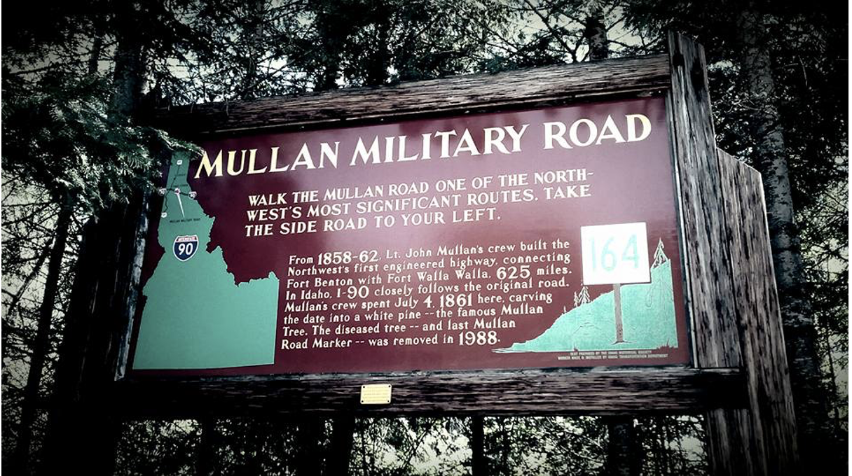
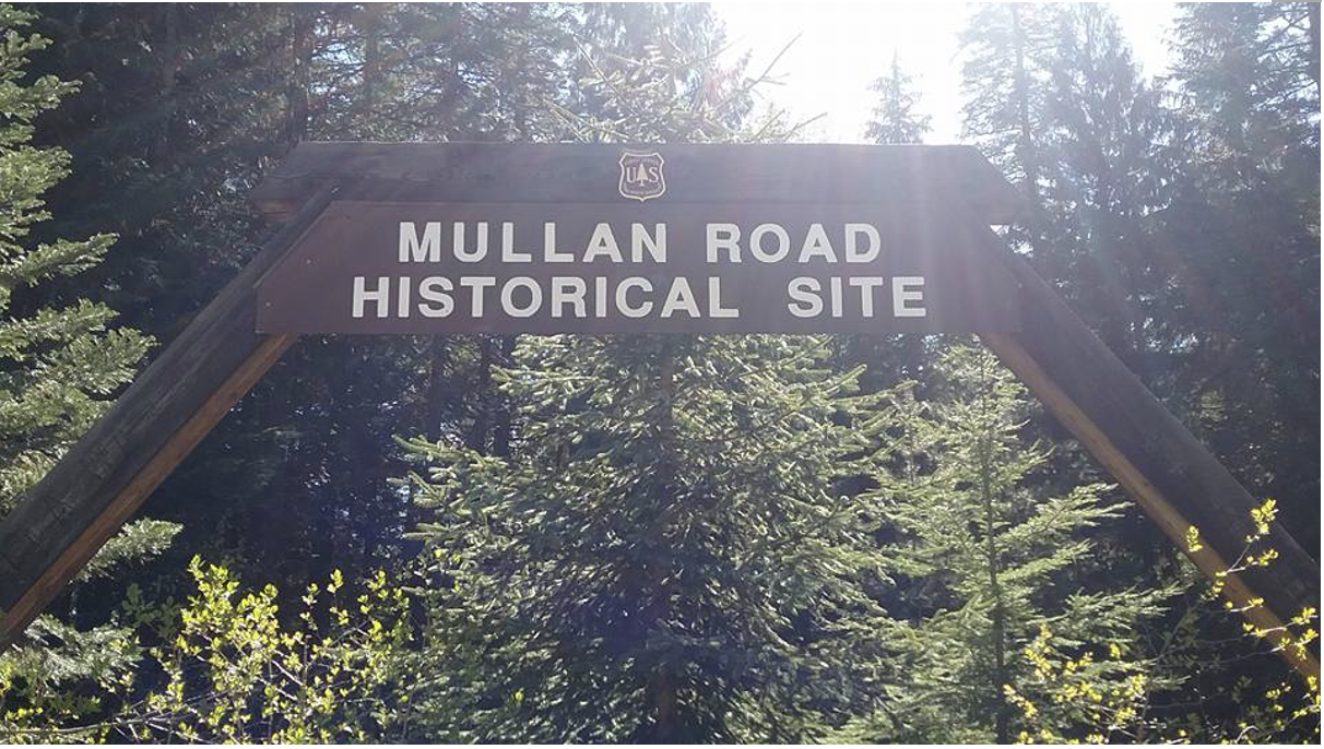
4th of July Pass – Monument to Mullan
Bibliography:
1. Krueger, Carl G., Supervisor of the Coeur d’Alene National Forest. “Route of the Mullan Road Over the Bitterroot Divide.” August, 1964. Northwest Room. Spokane Public Library.
2. Map of Military Road from Fort Walla Walla on the Columbia to Fort Benton to the Missouri. 1858-1863. “Letter From the secretary of War:” Reports of Captain William Mills and Lieut. William J. Turner concerning work performed on the Mullan Wagon Road, Montana Territory. December4, 1879. 46th Congress, 2nd. Session. Senate. Ex. Doc., No. 3.
3. Ferris, Joel E. NW Room Archives Clip. Spokesman Review. “Once Were Common on Inland Empire Trails. Huge Loads on Rugged Routes of Spokane Country and The Expansive Minion Regions.” August 1, 1954.
4. Letter to Secretary of War, Geo. W.McCrary, September 23, 1877 from General Sherman. Northwest Room Archives. Clip.
5. “Letter From the secretary of War:” Reports of Captain William Mills and Lieut. William J. Turner concerning work performed on the Mullan Wagon Road, Montana Territory. December4, 1879. 46th Congress, 2nd. Session. Senate. Ex. Doc., No. 3.
6. NPS Form. 10-900. No. 1024-0018. Point of Rocks National Registration Form. United States Dept.of the Interior. July 24, 2009.
7. The National System of Trails Act of 1968. Nps.gov.
8. Gary Werner. Executive Director of National Trail System Coalition. gary@pnts.org. www.pnts.org. 608.249.7870.
9. Helen Scully, National Recreation Trails Coordinator, Washington, D.C. helen_scully@mps.gov. 202.354.6910. Phone interview. May 2, 2017.
10. https://en.wikipedia.org/wiki/National_Scenic_Trail.
11. Spokesman Review clip. Nov. 26, 1961. Northwest Room. Spokane Public Library.
12. McDermott, Paul D., Grim, Ronald E. and Mobley, Phillip. The Mullan Road. Carving a Passage through the Frontier Northwest, 1859-1862. Mountain Press Publishing. Missoula, MT. 2015.
Screenshot 2026-10-08 at 2.09.07 PM
Screenshot 2026-10-08 at 1.58.32 PM
Screenshot 2026-10-08 at 1.58.43 PM
Screenshot 2026-10-08 at 1.58.53 PM
Screenshot 2026-10-08 at 1.59.08 PM
Screenshot 2026-10-08 at 1.59.16 PM
Screenshot 2026-10-08 at 1.59.24 PM
Screenshot 2026-10-08 at 1.59.32 PM
Screenshot 2026-10-08 at 1.59.44 PM
Screenshot 2026-10-08 at 1.59.51 PM